
Whether you’re navigating Canadian coastal routes or pushing through deep-sea channels off the Gulf, clear and reliable communication is non-negotiable.
A ship’s ability to coordinate with ports, send data back to headquarters, or handle emergencies depends entirely on the communication systems it carries. No single device does it all. Instead, it’s a full network working in sync: VHF radios for local coordination, AIS communication for vessel tracking, and satellite systems for long-range coverage.
This article breaks down the key components of marine communication systems, what role each plays, and how they work together to keep vessels connected.
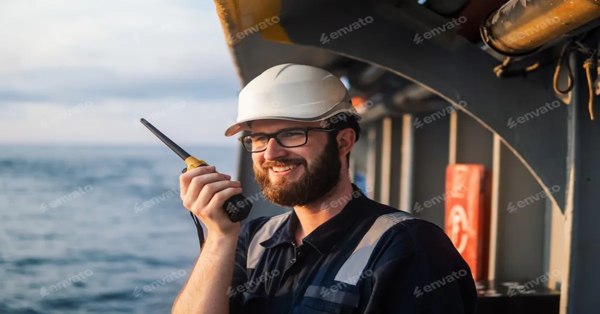
VHF Radio
VHF (Very High Frequency) radio is essential for marine communication. It’s used for short-range, line-of-sight communication between ships, and between ships and coastal stations. If you’re within about 20 to 30 nautical miles of another vessel or a shore station, your VHF is your most direct tool for calling in updates, checking vessel positions, or raising an alert.
VHF is the primary tool for:
- Ship-to-ship coordination, like passing arrangements in narrow channels
- Calling into harbors and marinas before docking
- Weather broadcasts and navigational warnings from the Coast Guard
- Emergency hailing is handled through Channel 16, the international distress frequency that is continuously monitored
You might think, in the age of satellite everything, that VHF is outdated. But it’s not. It’s fast, simple, and doesn’t rely on the internet or a satellite constellation. In real-time situations like a ferry approaching a port or a trawler working near other boats, it’s often the most effective tool for direct coordination.
Plus, it’s reliable in ways that digital systems sometimes aren’t. There’s no login, no signal delay, just a button and a voice.
Limitations You Should Know
Since it works line-of-sight, signal strength decreases with distance or obstructions like islands or large vessels. It’s also voice-only, so it can’t transmit location or data unless paired with Digital Selective Calling (DSC), which not every boat is equipped to use properly.
But limitations aside, every vessel, whether commercial, recreational, or industrial, needs VHF. It’s the starting point of any marine safety communication plan.
AIS
The Automatic Identification System (AIS) essentially broadcasts your vessel’s identity, position, speed, and course every few seconds. AIS signals are sent over VHF frequencies, so they’re also line-of-sight, but they update much more frequently and transmit precise location data. This helps build situational awareness on crowded routes or in poor visibility.
According to the IMO’s SOLAS regulations, AIS is mandatory for:
- All vessels over 300 gross tons on international voyages
- All cargo ships over 500 GT not on international routes
- All passenger ships, regardless of size
Recreational and smaller commercial vessels aren’t required to use AIS, but many still do, especially in high-traffic areas or offshore operations where additional visibility adds an extra layer of safety.
It offers instant vessel identification, enables early collision avoidance, and improves tracking from shore via satellite. However, it depends on line-of-sight and proper setup. If a vessel’s AIS communication is switched off, out of range, or misconfigured, it disappears from view. Also, it’s not a collision avoidance system on its own. You still have to use radar, lookout, and good seamanship as AIS just gives you better data to work with.
Satellite Communication
Once a vessel moves beyond the coastline, whether it’s a research ship in the Labrador Sea or a container vessel crossing the Pacific, line-of-sight tools like VHF and AIS begin to lose effectiveness. At that point, satellite communication becomes essential.
Satellite systems are what keep vessels connected to the shore, no matter how remote their route. They allow for real-time tracking, broadband internet, operational reporting, email, crew calls, and increasingly, IoT systems that manage everything from engine performance to cargo temperature.
Most commercial vessels now run some form of hybrid satellite setup:
- VSAT systems (on Ku-, Ka-, or C-band) for high-bandwidth internet, often used for business ops, data syncing, and crew welfare like video calls and Wi-Fi
- L-band systems (like Inmarsat FleetBroadband or Iridium Certus) as backup channels for voice and low-data needs in remote areas
- Some are now adding LEO (low Earth orbit) systems like Starlink or OneWeb for even faster speeds and lower latency, especially in the Arctic and far offshore
Each of these serves a different purpose. But together, they ensure the ship is never out of touch.
Here’s who uses it and how:
- Offshore rigs use satellite links to send live sensor data to headquarters
- Fishing fleets rely on it to report catch volumes or weather changes from remote zones
- Naval and research ships use it to update charts, communicate with land teams, and monitor onboard systems in real time
- Passenger vessels use it to keep both crew and customers online throughout the journey
Satellite communication offers global coverage, including in polar and equatorial blind spots. It improves safety by ensuring constant ship-to-shore connectivity, even during emergencies.
Real-time monitoring, reporting, and system optimization boost operational efficiency, while internet access for calls, news, and staying in touch supports crew morale.
For vessels in remote or unpredictable waters, satellite communication keeps operations moving, crews connected, and vital data flowing without pause.
GMDSS and Safety Systems
The Global Maritime Distress and Safety System (GMDSS) removes delay and human error from emergency communication. It’s a coordinated network of satellite and radio tools that can automatically send distress signals, locate lifeboats, and help direct rescue efforts when every second counts.
Key Components
- EPIRBs: Activate on impact or submersion, sending your position via satellite.
- SARTs: Respond to radar to help locate lifeboats or survival craft.
- DSC: Lets you send an instant digital distress call from your VHF or MF/HF radio.
- Inmarsat-C / Iridium: Send reliable alerts from remote areas.
GMDSS systems are mandatory for vessels under SOLAS like commercial ships over 300 GT or any international passenger vessel. Equipment depends on your sea zone: VHF for coastal, satellite for open ocean.
It can trigger alerts even if the crew is incapacitated. That automation has saved over 63,000 lives through the Cospas-Sarsat system. This is proof that when the worst happens, GMDSS is what works.
The Rise of Internet-Based Marine Communication
Marine communication has come a long way. Radios aren’t going anywhere, but crews now expect more live data, cloud access, video calls, and real-time updates from ship systems.
Inmarsat says maritime data usage jumped 131% year-over-year and more than 80% of it was for operations and crew welfare, not just safety systems.
Modern vessels are equipped with far more than just radios. IP-based systems, smart tracking devices, digital logbooks, and onboard Wi-Fi are becoming standard. When issues come up, shoreside teams can step in remotely.
Hybrid communication setups are now essential. VHF remains key for voice, AIS ensures vessel visibility, satellite systems like VSAT and L-band handle long-range data, and cellular fills the gap near shore. Together, they help minimize downtime, improve situational awareness, and support faster decision-making on the water.
Reliable Communication is the Backbone
Marine operations rely on consistent, uninterrupted communication. Without it, navigation suffers, safety protocols weaken, and routine operations slow down.
From short-range VHF and AIS to global satellite coverage and automated systems like GMDSS, each component plays a role in maintaining coordination, safety, and operational efficiency. When your comms hold steady, everything from navigation and maintenance to crew support and emergency response runs more smoothly.